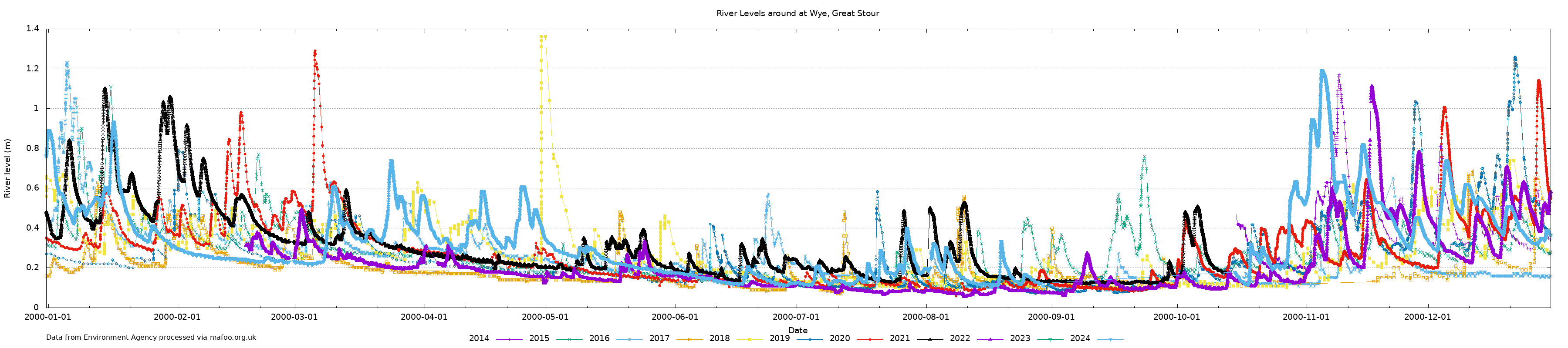
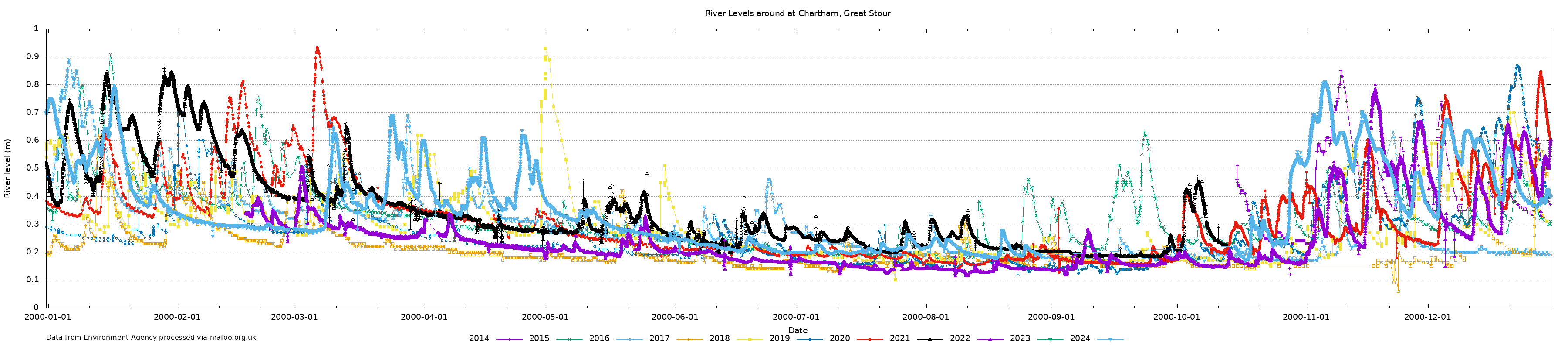
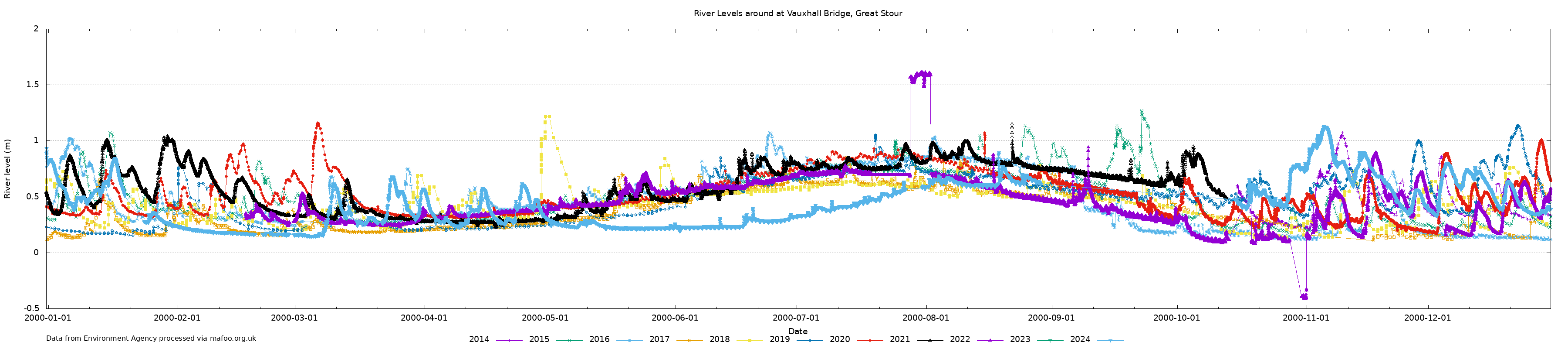
The charts below show the annual levels of the Great Stour at various locations between Ashford and Canterbury in Kent.
Data collection began in 2014 for Wye, Chartham, and Vauxhall bridge. Westgate Gardens is a newer monitoring station and data is available back from 2020. There are a few periods of time where data is unavailable normally due to changes in the upstream data availability.
Data has been gathered from the Environment Agency in England and is available under the the Open Government Licence v3.0, except where otherwise stated.
If you'd like a copy of the underlying data then please drop me an email.